
LandtapeLandtape

Tape measure for land

Tap the corners of any lot, yard or field on the satellite map, or walk around it. The area shows right away.

Coming soon to the App Store

For iPhone. Three measurements free, no account.

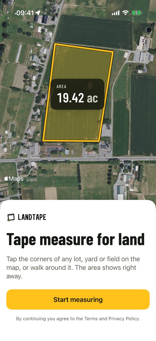
Landtape on iPhone: a field on the satellite map outlined in yellow, AREA 19.42 ac, and the line Tape measure for land.
4 taps

Four corners and you have the acres. Drag any corner to fine-tune it.

±3 m

Typical GPS accuracy in the open when you walk the boundary. The app shows it live.

0 sign-ups

No account. Your measurements stay on your iPhone and in your own iCloud.

Area

Tap the corners, get the acres

Find your land by address or coordinates, tap each corner on the satellite picture and close the shape. Landtape shows the area in acres, hectares, square feet and square meters, plus the perimeter.

  • Drag corners and add points on any side
  • Undo and redo every step
  • Satellite, hybrid and standard maps
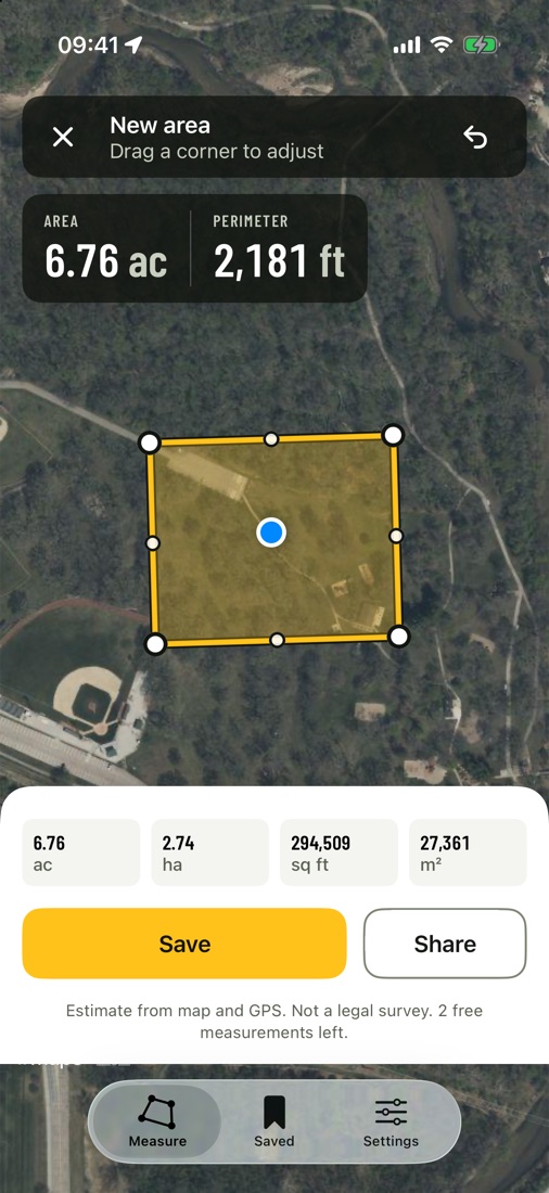
A measured area: 6.76 acres and 2,181 feet around, with the size in four units below.
Distance and price

Price a fence before you quote it

Measure a fence line, a driveway or a field edge and type your price per foot. Landtape multiplies it for you, so the quote is ready while you are still on site.

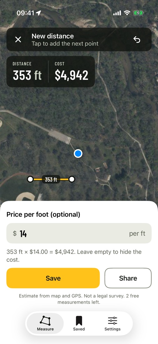
A distance of 353 feet at 14 dollars per foot, cost 4,942 dollars.
Walk and save

No clear corners? Walk the edge

Start a GPS walk and go around the plot. Recording keeps going with the screen locked, and the area appears when you get back to the start.

Every measurement is saved on your iPhone and in your iCloud. Share a one-page PDF report, a picture of the map, the numbers or a KML file for Google Earth.

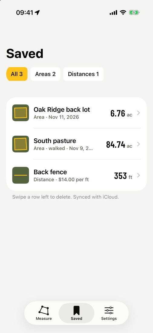
The Saved list with three plots: Oak Ridge back lot, South pasture and Back fence.

Pay after you see it work

Free
3 measurements

Full results with every unit, saving, reports and exports. What you save stays open forever.

3 DAYS FREEPro yearly
$49.99 per year

Unlimited areas, distances and GPS walks. Cancel in the trial and pay nothing.

Pro weekly
$9.99 per week

For a single job. No trial, cancel any time in your Apple Account.

Prices in US dollars. The App Store shows the price for your country. Subscriptions renew until you cancel in your Apple Account settings.

Questions

How accurate is it?

Tapped corners are as good as the satellite picture and your taps, usually within a metre or two when you zoom in. A GPS walk is usually within 3 to 5 metres in the open and less precise near buildings and trees. Every result is an estimate from map and GPS, not a legal survey.

Do I need an account?

No. There is no sign-up. Measurements are stored on your iPhone and synced through your private iCloud.

Does it work outside the US?

Yes. The satellite map covers the world, and Landtape picks imperial or metric units from your region. You can switch in Settings.

Can I open the results in Google Earth?

Yes. Export a KML file from any saved measurement. You can also share a PDF report or a picture of the map.